Tracking Wildfires in Real-Time with FireMaps
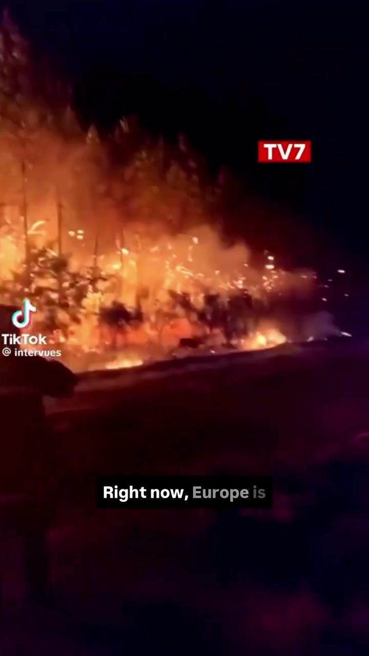
Wildfires have become an increasingly pressing issue, especially in regions like Europe where thousands of hectares are going up in flames, particularly in France and Spain. In response to this urgent need, a innovative solution has emerged: FireMaps. This free platform leverages NASA satellite data to track wildfires in near real-time, providing a crucial tool for those affected by these destructive events.
Why This Matters
Wildfires pose significant threats to both human life and the environment. They can destroy homes, displace communities, and cause severe ecological damage. Effective monitoring and response systems are essential for mitigating these risks. FireMaps addresses this need by offering a comprehensive platform that combines satellite data with user-contributed information, making it an invaluable resource for both individuals and emergency responders.
Main Discussion
The Technology Behind FireMaps
FireMaps relies on NASA satellite data to provide real-time updates on wildfire locations and movements. This data is integral to the platform's accuracy and reliability. By using satellite imagery, FireMaps can track the spread of fires with a high degree of precision, ensuring that users have the most up-to-date information available.
User Contribution
What sets FireMaps apart from other tracking tools is its community-driven approach. Users can report wildfires, draw the exact perimeter of the fire, and upload photos or videos directly from the field. This crowd-sourced data enhances the platform's accuracy and usefulness. The more people contribute, the more detailed and reliable the information becomes, creating a collaborative network that benefits everyone.
Key Features
FireMaps includes several key features designed to aid in wildfire tracking and response:
- Real-Time Updates: The platform provides near real-time updates on wildfire locations, ensuring that users have the latest information.
- User Reports: Users can report wildfires and upload photos or videos, enhancing the platform's data accuracy.
- Evacuation Centers: The platform includes information on evacuation centers, helping people find safety during emergencies.
- Other Tools: FireMaps offers a range of additional tools to support users affected by wildfires, from maps to emergency contacts.
The Power of Collaboration
The platform's success relies heavily on community involvement. Just like the popular navigation app Waze, FireMaps leverages user contributions to provide the most accurate and useful information. By encouraging users to share their observations, FireMaps can offer a comprehensive view of wildfire activity, helping to protect lives and property.
Practical Tips
How to Use FireMaps
Using FireMaps is straightforward and user-friendly. Here are some practical tips to get the most out of the platform:
- Download the App: FireMaps is available for free, making it accessible to anyone with a mobile phone.
- Report Wildfires: If you see a wildfire, use the app to report it. Provide as much detail as possible, including the exact location and any relevant observations.
- Upload Media: Photos and videos can provide valuable context. If you capture any media related to a wildfire, upload it directly through the app.
- Stay Updated: Keep the app running to receive real-time updates on wildfire locations and movements.
- Share and Contribute: Encourage others to use FireMaps and contribute their observations. The more data the platform has, the more accurate and useful it becomes.
Maximizing User Contributions
To enhance the platform's effectiveness, consider the following:
- Accuracy: Ensure that all reports and media uploads are as accurate as possible. Inaccurate information can mislead other users and emergency responders.
- Timeliness: Report wildfires and upload media as soon as possible. Timely information is crucial for effective response efforts.
- Community Engagement: Engage with the community by sharing updates and encouraging others to use the app. The more users contribute, the stronger the platform becomes.
Important Takeaways
FireMaps represents a significant advancement in wildfire tracking and response. By combining NASA satellite data with user-contributed information, it provides a comprehensive and reliable tool for monitoring wildfires in near real-time. The platform's success hinges on community involvement, making it a powerful example of how technology and collaboration can address critical challenges.
Conclusion
In the face of increasing wildfire threats, FireMaps offers a beacon of hope. Its innovative use of satellite data and user contributions creates a robust system for tracking and responding to wildfires. By embracing this platform, we can work together to protect lives and the environment, making a real difference in the fight against these devastating fires.
Questions readers ask
How does FireMaps track wildfires in real-time?
FireMaps utilizes NASA satellite data to monitor and track wildfires across Europe in near real-time. This data allows the platform to provide precise and up-to-date information on fire locations, helping users stay informed about ongoing wildfire situations and locations.
Can individuals contribute to FireMaps by reporting wildfires?
Yes, FireMaps empowers users to report wildfires, which enhances the platform's accuracy and usefulness. By allowing individuals to contribute, FireMaps ensures that even small or newly ignited fires can be quickly identified and tracked, aiding both local communities and emergency responders.
What regions in Europe are primarily covered by FireMaps?
FireMaps focuses on regions in Europe where wildfires are most prevalent, particularly in countries like France and Spain. The platform aims to provide comprehensive coverage of these areas to support effective wildfire management and response.
Is FireMaps available for free?
Yes, FireMaps is a free platform designed to provide accessible and useful wildfire data to the public. By offering free access, the platform aims to support a wide range of users, from individuals concerned about their safety to emergency responders managing wildfire response efforts.
How can tracking wildfires in real-time benefit emergency responders?
Real-time wildfire tracking through platforms like FireMaps is invaluable for emergency responders. It enables them to quickly assess the situation, deploy resources effectively, and coordinate response efforts, ultimately enhancing the safety and well-being of communities affected by wildfires.
What kind of data does FireMaps provide about wildfires?
FireMaps offers detailed and useful information about wildfires, including their exact locations, the extent of the burn, and real-time updates on the fires' spread. This data is crucial for both individuals looking to stay safe and for emergency services coordinating a response.
How can users stay updated with the latest wildfire information on FireMaps?
Users can stay updated with the latest wildfire information on FireMaps by frequently visiting the platform. The real-time updates ensure that users have access to the most current data, allowing them to make informed decisions and stay safe during wildfire events.
Related deep dives
Similar reads based on topic and creator.

Recent articles
Fresh deep dives from the latest Reels we unpacked.




Comments
Be the first to comment.