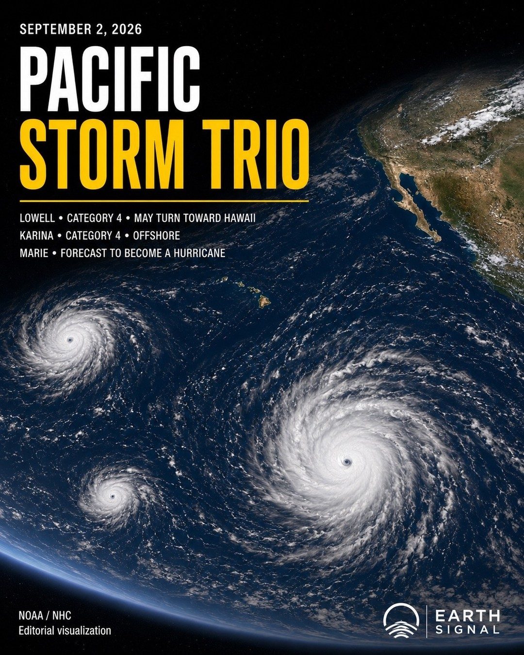
The Pacific's Triumvirate of Tempests
The Pacific Ocean is currently teeming with activity, hosting three significant storms. Hurricane Lowell, a formidable Category 4 storm, is the most concerning due to its potential path toward Hawaii. This looming threat underscores the urgency of preparedness for the Hawaiian islands. Lowell is not the only storm demanding attention. Tropical Storm Karina, another Category 4, is presently remaining offshore, yet its status as a major storm must be closely monitored. Tropical Storm Marie, forecast to intensify into a hurricane, adds another layer of complexity to the region's weather dynamics. Earth Signal is critical in highlighting these threats, but the public must understand the implications of the data they share. The differential paths of these storms illustrate the unpredictable nature of Pacific hurricanes. Lowell's trajectory toward Hawaii poses an immediate threat, while Karina’s offshore status, although reassuring, does not negate the need for vigilance. Marie’s forecast to become a hurricane further complicates the situation, requiring constant monitoring and adaptive responses. The ability to track and predict these storms’ paths are vital for early warnings and preventive measures.
Disentangling the Storms
Strategic priorities shift as Hawaii braces for the potential landfall of Hurricane Lowell. The island's infrastructure, though resilient, must prepare for the worst. Local authorities are likely mobilizing resources, ensuring shelters are ready, and coordinating with federal agencies like NOAA (National Oceanic and Atmospheric Administration) and the National Hurricane Center (NHC). The real-time data from NOAA/NHC, labeled as an editorial visualization by Earth Signal, serves as the backbone of these preparations, guiding decisions and resource allocation. Meanwhile, Karina’s Category 4 status, despite being offshore, is a reminder of the Pacific’s volatility. While it currently poses a lesser direct threat, its strength and potential shifts in trajectory demand constant vigilance. The public must stay informed through credible sources, understanding that offshore does not mean inconsequential. Preparations for potential evacuations, stockpiling of supplies, and community awareness campaigns are crucial, even if the immediate threat seems distant. New players, like Tropical Storm Marie, also deserve attention. Marie's forecast to become a hurricane adds another element to the Pacific’s stormy tapestry. This potential hurricane, though not yet full-fledged, requires vigilant monitoring. Marie's development into a Category-level storm can quickly escalate the situation, necessitating timely interventions and strategic adjustments for resource management. This makes Earth Signal and NOAA/NHC's official reports an essential tool for understanding Marie's potential trajectory.
Related deep dives
Similar reads based on topic and creator.


Recent articles
Fresh deep dives from the latest Reels we unpacked.
Comments
Be the first to comment.